Parks & Trails
Bullhead City Community Park
Address: 1251 Hwy 95, Bullhead City 86429
Admission: May - October non-Bullhead City residents $25 per vehicle
Hours: 4:30am - 11pm
Bullhead City Community Park is a 376‑acre riverfront gem featuring nearly a mile of sandy Colorado River shoreline, perfect for boating, fishing, swimming, or simply relaxing with a picnic. Visitors can explore historic landmarks like the Colorado River Museum and Little Red Schoolhouse, let the kids play on shaded playgrounds, or enjoy open lawns and a dedicated dog park. With reservable ramadas, a seasonal riverside café aboard the Bullhead Belle, and sweeping views of the Black Mountains, it’s a welcoming hub for recreation, history, and community gatherings.
Colorado River Nature Center
Address: 900 Ricardo Ave, Bullhead City, 86442
Hours: Day-use only, sunrise to sunset
The sprawling 500-acre Colorado River Nature Center is a unique urban preserve dedicated to providing a “natural environment for low-impact recreation,” supported by the Arizona Game & Fish Department, the City of Bullhead City, and the Bureau of Land Management. Highlights include access to the sandy Rio Lomas Beach—busy in summer for swimming and wading—and a network of multi-use trails, ranging from paved educational loops with wildlife signage to unpaved pathways winding through riparian woods and backwaters. Birdwatchers and photographers often flock to the area, as its cottonwood stands and marshes are home to great blue herons, egrets, and a variety of migratory songbirds. Fishing is permitted under Arizona rules, but hunting and firearms are prohibited, maintaining a peaceful atmosphere. Visitors are strongly cautioned to watch for diamondback rattlesnakes, especially in warmer months, and to keep dogs leashed at all times. Picnic areas and shade structures make this a prime locale for family outings, though overnight camping is not allowed. Temperatures can vary significantly—dress appropriately and pack water.
Heritage Greenway Park & Trails
Address: 1555 S Casino Dr Laughlin, NV 89029
Hours: Daily, 6am - 11pm
The Colorado River Heritage Greenway, also known as Laughlin Riverwalk, is a highlight for outdoor enthusiasts, combining river views, historic sites, and 9 miles of well-designed multi-use trails. Built in 2012 under the Bureau of Reclamation and part of Lake Mead National Recreation Area, it features trailheads with parking and restrooms, shaded picnic sites, fishing piers, and a signature pedestrian overpass. Visitors praise the Riverfront Trail’s full accessibility, offering smooth passage for wheelchairs or strollers. The Horseshoe and Desert Trails introduce mild-to-moderate challenges for hikers, bikers, and equestrians—ideal for experiencing native flora and wildlife. The park’s proximity to Davis Dam allows for striking views and unique photo opportunities, though the dam itself is not open for public tours. Shade is limited along the trails; bring a wide-brimmed hat, sturdy shoes, and plenty of water. Trails are well-marked and safe, but always check weather conditions and avoid storms. Structures can be reserved for groups through Clark County Parks, making this a strong venue for family reunions or events.
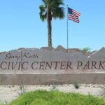
Gary Keith Civic Center Park
Address: 2295 Hoppas Dr, Bullhead City 86442
Hours: 4:30am - 11pm
Gary Keith Civic Center Park is a 22 acre parcel located in the center of Bullhead City, Arizona. The location is ideal due to its close proximity to the City of Bullhead City Administration Complex, Mohave High School.
Civic Walkway incorporates landscape and picnic ramadas along with walking paths.
The 170,000 sq ft Open Event Center will provide area civic groups and outside venues a highly visible location for the events.
Performing Arts Pavilion will provide multiple uses such as outdoor plays, concerts and local entertainment from schools and area groups. It is designed with stage sound & lighting to include front of house controls, dressing rooms and storage.
Rotary Park
Address: 2315 Balboa Drive Bullhead City, AZ 86442
Hours: 4:30am - 11pm
One of Arizona’s largest riverside parks at 300 acres. Amenities here are outstanding: lighted athletic fields, tennis/pickleball, disc golf, extensive beach, dog park, skate park, boat launch, and clean restroom facilities. It is very family-friendly, with shaded playgrounds and extensive picnic ramadas available for daily rent. The riverfront area is the most popular for water recreation and launches. For those trail-walking or running, the 3.2-mile riverwalk trail is easy and well-maintained. Regulations emphasize safety: 5 mph vehicle limit, leash rules for pets, and no glass bottles. Boaters must pay a launch fee (discounted rates for residents, annual passes available), while general park entry is free.
Lake Mohave/Katherine Landing
Address: 2690 Katherine Dr, Bullhead City, AZ 86429
Admission: $25 per vehicle for 7-day pass
Hours: 24 hours, visitor center hours vary
Fisherman’s Trail is a defined one mile trail leading to Turkey Cove. A long sandy cove with minimal trail climbed through several low hills.
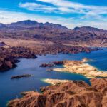
Lake View Trail is on the southern end of Lake Mohave just north of Bullhead City and Laughlin. This moderate 4.7 mile round trip is somewhat uneven with some elevation changes. You will come upon several coves along the trail which will end at Telephone Cove. Trail is not maintained. Cell reception may be limited in canyons - note navigation and plan for emergencies accordingly!
Boundary Cone
"Address" : XHPF+68, Fort Mohave, AZ 86413 - in Google Maps - just off Oatman Highway
Be advised cellular signal may be spotty in areas - please plan accordingly - 1.5 miles – Challenging – Out and Back – 1,394ft elevation gain - This trail near Oatman is for experienced hikers. Lots of loose rock and cliffs. AI-generared review: "Highlights include great views, peace, and unique mines along the way. Challenges are steep climbs, loose rocks, and navigation issues. Reviewers recommend wearing sturdy shoes and checking for cairns."
Grapevine Canyon Trail
Address: Grapevine Canyon Rd, Searchlight, NV 89046 (down Christmas Tree Rd)-
Hours: Day-use only, sunrise to sunset
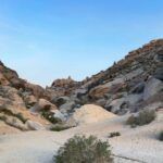
Approximately 3.30 miles – Moderate – Elevation gain 374ft - Out and back trail located on Spirit Mountain near Laughlin, NV. Grapevine Canyon is known for over 700 petroglyphs and is on the United States National Register of Historic Places. There are scrambling over rocks and boulders with many rock shelters. Depending on the season, there may be a water stream at the end of the trail.
White Cliffs Wagon Trail
Address: White Cliffs Wagon Trail, Kingman, AZ 86401
Hours: 24 Hours
Located about 5 miles north of downtown Kingman this trail system features a dozen of trails of varying difficulties. carved in from mining wagons in the late 1800’s bringing ore from Stockton Hill Mines to the railroad. Geological wonders abound with historical significance plainly seen through various wagon tracks.
Mt Nutt Wilderness
This sprawling BLM-managed wilderness area is located in the rugged Black Mountains near Oatman and Golden Valley. It is a place of solitude and natural scenery, popular for hiking, backpacking, and photography. The terrain is extremely rugged, and most hiking is done on sandy washes or trails made by bighorn sheep and burros. A notable trail is the 0.8-mile Cave Spring Trail, a steep hike that leads to a natural spring and offers views of the Sacramento Valley. The Secret Pass OHV Trail, a 12-mile route, is popular for off-roading. The area is home to desert bighorn sheep, wild burros, and a variety of other desert wildlife. Visitors should be prepared for extreme temperatures and lack of water sources.
Monolith Garden Trail
Address: Metwell Dr, Kingman, AZ 86401
Hours: Open 24 Hours
The Monolith Garden Trail is an 8.5-mile series of loops and is part of the larger Cerbat Foothills Recreation Area trail system, located just west of Kingman. This trail is an easy to moderate route open to hikers, mountain bikers, and trail runners. It meanders through Mohave Desert vegetation and fascinating volcanic rock formations, with little shade and no water available. The trail connects to the Camp Beale Loop Trail, allowing for a longer exploration. Popular trailheads include Coyote Pass and Metwell Drive.
Badger Trail
Address: 3326-3378 US-93, Golden Valley, AZ 86413
Hours: Day use only, sunrise to sunset
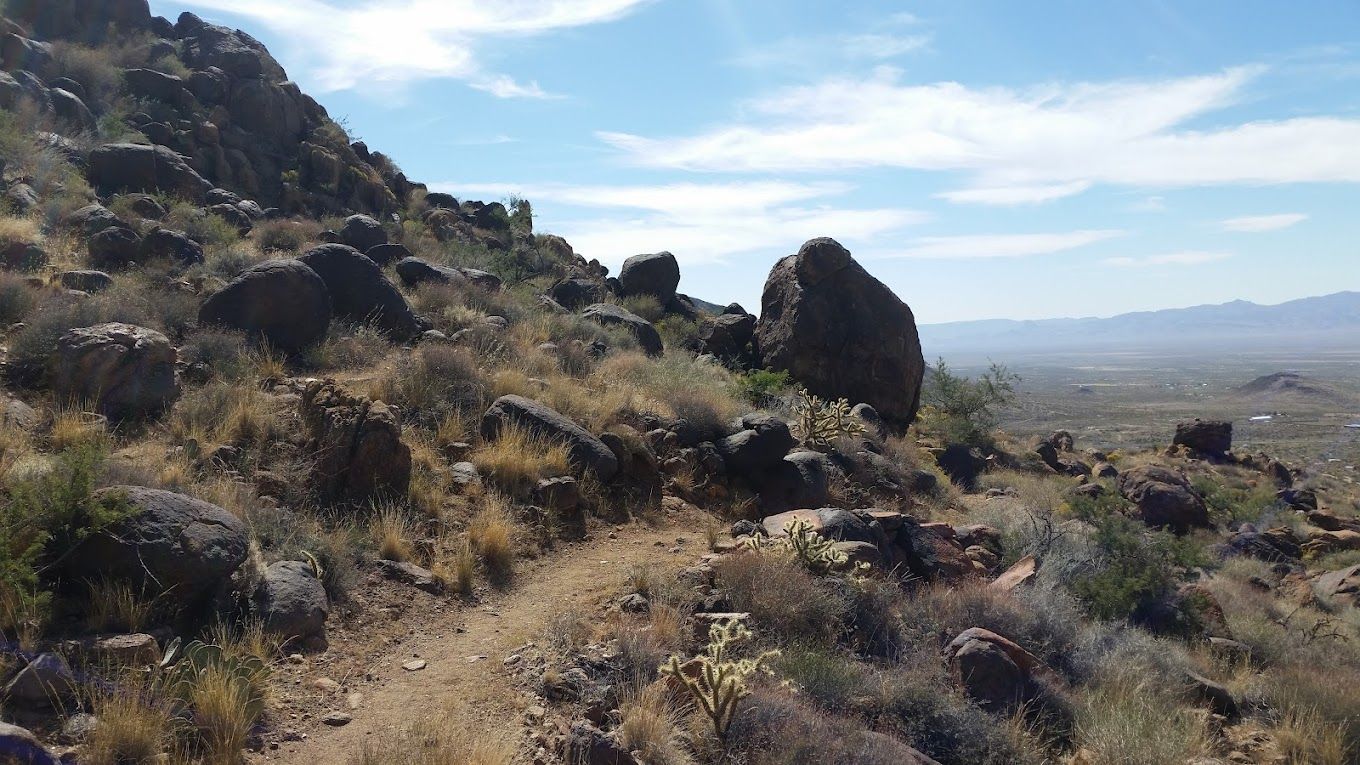
3.2 miles – Out and Back – Elevation gain 1076ft –Moderately challenging with a consistent 8% grade. Beautiful wildflower displays and spectactular views of the surrounding valleys and mountains. Giant granite boulders and white quartz are especially prominent along the well maintained trail. Dress for full sun and bring plenty of water!
Camp Beale Loop Trail
Address: 2699 Fort Beale Drive, Kingman, AZ 86401
Hours: Open 24 Hours
A very popular trail of the Cerbat Foothills Recreation Area and is a great connect to Castle Rock Trail. With sine sections of steep incline, around 10-12% this trail grades as moderate difficulty with an elevation gain of about 500ft. Beautiful scenic views abound while hiking atop a mesa. Camp Beale trails are availble for hiking, horseback riding, and trailrunning.
Big Bend of the Colorado State Rec Area
Address: 4220 South Needles Hwy #3 Laughlin, NV 89029
Admission: $15 for non-Nevada vehicles, see link for more admission info
Hours: Depends on season, generally 7am-6pm
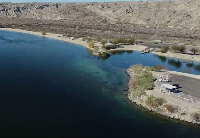
The expansive 2,100-acre Big Bend of the Colorado State Recreation Area is a scenic preserve dedicated to providing a "natural environment for low-impact recreation," supported by Nevada State Parks. Situated just south of Laughlin, Nevada, on the west bank of the Colorado River, the park offers stunning views of the river and the surrounding desert canyons. Highlights include two miles of sandy shoreline, a two-lane boat launch ramp for river access, and a network of trails, including a paved interpretive loop and unpaved pathways that wind through the riparian areas.
The area is a popular destination for fishing, boating, and swimming in the cool, clear waters of the Colorado River. Birdwatchers and photographers often flock to the park, as its cottonwood stands and washes are home to a variety of waterfowl and shorebirds, including mallards, herons, and geese, as well as hawks, quail, and roadrunners.
Fishing is permitted under Nevada rules, and a variety of species can be caught. The park offers day-use facilities with picnic areas, shade ramadas, and barbecue grills, some of which can be reserved in advance, especially during the peak summer season. A 24-unit RV campground with full hookups and a separate area for first-come, first-served tent camping are also available. Visitors are strongly cautioned to watch for desert wildlife.
Arizona Peace Trail
"Address": staging area is intersection of Silver Creek Rd and Bullhead Parkway
This is a vast, 675-mile multi-use trail system for off-highway vehicles (OHV) that spans across the Mohave and La Paz counties. The trail is well-known for its rugged, scenic routes, connecting a variety of desert landscapes, historic mining towns, and remote wilderness areas. While the trail can be accessed at numerous points throughout the region, the Bullhead-Kingman-Oatman area serves as a key hub. The trail is suitable for a range of OHV types, from dirt bikes to UTVs. Users are advised to carry plenty of water and fuel, have navigation devices, and be prepared for remote conditions. The trail is a draw for off-roading enthusiasts seeking a challenging and immersive desert adventure.
Upper Hiko Springs
Address: Nevada 89029, just off NV-163 W
3.40 miles – Moderate – Elevation gain 429ft – Out & Back
The Hiko Springs Canyon Trail is a 3.4-mile out-and-back trail with a moderate rating and an elevation gain of 429 feet, located near Laughlin, NV. It offers a peaceful and scenic walk through a spring-fed canyon in the Newberry Mountains, which are part of the Avi Kwa Ame National Monument and hold profound spiritual significance for local Native American tribes. The trail follows a wash, with towering cliffs on either side, and is well-known for its ancient petroglyphs and historical etchings. While the path is relatively smooth, hikers should be prepared for sun exposure and bring plenty of water.
John Hohstadt Interpretive Nature Trail
This is a 1.6-mile loop trail with a moderate rating and a 243-foot elevation gain. The trail starts out sandy and then becomes rocky, leading to a scenic viewpoint. It is located at the Colorado River Nature Center and provides an educational experience with signage about the local flora and fauna. This trail is a great option for a shorter, informative walk that offers a good workout and nice views.
Hualapai Mountain Park
Address: 6250 Hualapai Mountain Rd Kingman, AZ 86401
Located just outside of Kingman, this park is a dramatic escape into the cool pines of the Hualapai Mountains. At elevations ranging from 5,000 to over 8,000 feet, the park offers a welcome respite from the desert heat. It features 14 trails, including 6 miles of developed trails, with options for hiking, mountain biking, and horseback riding. The park has a unique character, with many of the roads, trails, cabins, and picnic areas originally built by the Civilian Conservation Corps in the 1930s. Amenities include rustic cabins, RV and tent camping, picnic areas, and group recreation areas. The park is a haven for wildlife watchers, with mule deer, elk, and a variety of birds frequently spotted.
